Relocating a creek to replace a failing dam and contaminated lake with a natural-functioning stream, floodplain, riparian areas, wetlands, and native fish habitat.
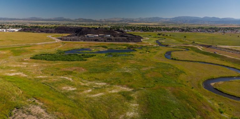
For over 100 years the East Helena Lead Smelter processed ore from thousands of mines in the region, producing over 20 million metric tons of slag and waste products that were dumped into the Prickly Pear Creek (PPC) floodplain. These activities contaminated soil and groundwater within the plant site, which created arsenic and selenium groundwater plumes under East Helena and extending up to 6.5km away from the site.
Through this project, which involved relocating PPC, the remaining on-site waste sources were successfully isolated and post-project monitoring showed almost immediate improvements to groundwater quality. The PPC Realignment project helped to successfully solve a century-old environmental problem immediately adjacent to a city, homes, farms, and residents.
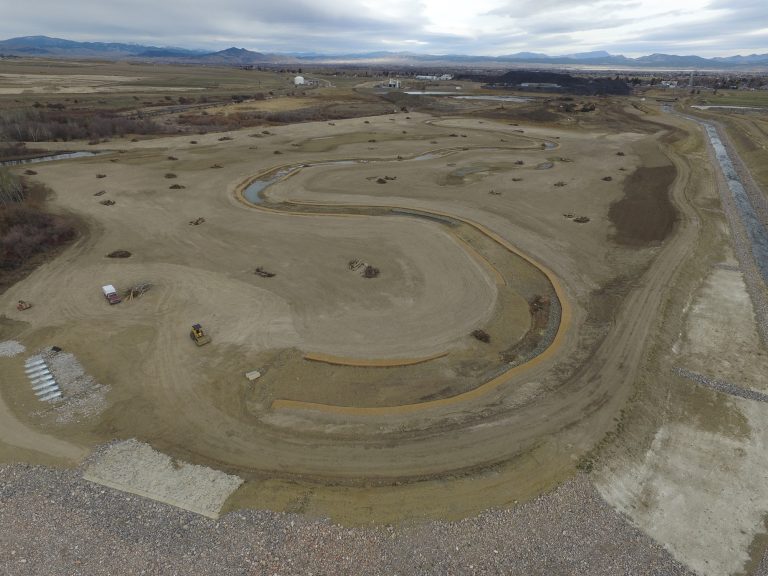
The project relocated a creek to replace a failing dam and contaminated lake with a natural-functioning stream, floodplain, riparian areas, wetlands, and native fish habitat. The relocated creek, floodplain, and wetlands complex created a permanent regional groundwater drain to drop groundwater beneath the contaminated soils at the site: this protects human health and the environment permanently by reducing groundwater contamination and isolates the site and slag pile without need for future pumping or maintenance.
This project incorporated two original/innovative techniques that were crucial to the project’s success and the reduction in schedule and costs. The first was the use of the entire creek corridor as a groundwater drain for the site. The presumed remedy for the site was pumping and treating contaminated groundwater in perpetuity.
Through various design charrettes, a concept was developed to remove the dam complex, consolidate and dispose of the contaminated sediments on site with other contaminated materials, reconstruct the stream at or near the pre-disturbance stream grade to act as a drain and lower the groundwater, and reconstruct the stream corridor with a natural mix of riparian areas and wetlands to replace those lost due to past operations and removal of the dam.
The second unique technique applied natural process-based channel and floodplain designs in a severely altered and space-constrained environment.
The project was bounded by the former smelter plant, slag pile, and associated waste management areas to the west; a contaminated soils repository to the east; an active railroad to the north; and a high-pressure gas pipeline to the south.
These constraints limited the space available for construction of a completely natural stream system with appropriate channel length, floodplain width, and floodplain slopes.
Instead, suitable stream and floodplain design analogues that could function naturally within these constraints were combined with appropriate engineered techniques rather than attempting to restore the system to a pre-human condition using more conventional design methods. These designs were developed in close consultation with geomorphologists, habitat experts, and hydrologists and were peer reviewed by the US Army Corps of Engineers River Experiment Station.
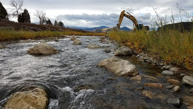
Pioneer developed and built new designs for energy-absorbing rock ramps that dissipated energy in higher energy reaches of the channel in several discrete steps while providing refugia and fish passage for all ages of native fish species at all flow rates.
Sorry, no records were found. Please adjust your search criteria and try again.
Sorry, unable to load the Maps API.
Company name Pioneer Technical Services, Inc.
Montana Environmental Trust Group


