


Nearly 50 years after its reconstruction following the Great Alaskan Earthquake, the iconic Seward Highway had reached the end of its design lifespan. A comprehensive $138 million, 15-mile rehabilitation project was undertaken to modernise and future-proof this critical transportation corridor.
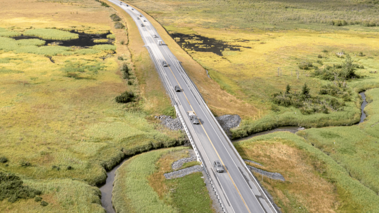
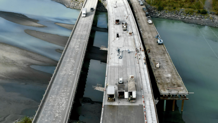
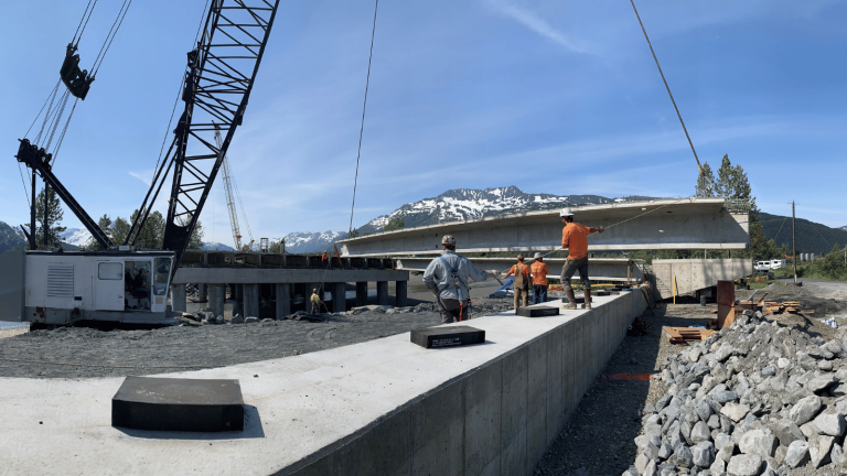
The project straightened hazardous curves; reconstructed, rehabilitated, and upgraded nine bridges; added five miles of passing lanes and intersection turn lanes; repaved the entire stretch; and enhanced pedestrian infrastructure, drainage systems, and shoreline protection. Three new underpasses and a multimodal trail were also introduced, significantly improving pedestrian safety and recreational access.
Despite facing formidable challenges—including a two-decade planning timeline, 30-foot tidal variations, short construction seasons, sub-zero winters, high seismic activity, and highly liquefiable soils—the project team successfully maintained continuous traffic flow throughout construction. Environmental stewardship remained a top priority, with protective measures implemented to safeguard critical and endangered species, including Beluga whales.
The result is a transformed Seward Highway—no longer a treacherous route, but a resilient, safe, and modern roadway that honours its natural surroundings while serving the needs of today’s travellers.
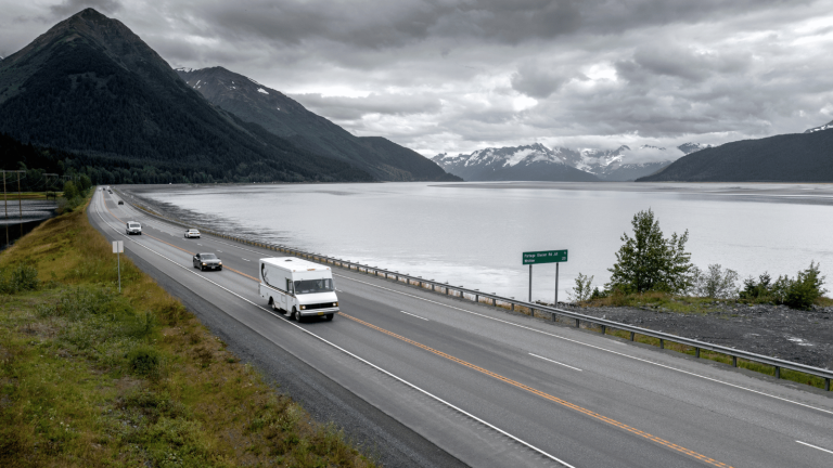
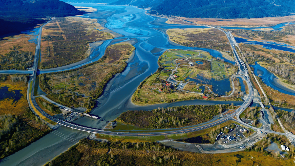
About 50 miles south of Anchorage, the Seward Highway winds along the breathtaking shoreline of Turnagain Arm—one of the most scenic stretches of highway in the United States. Expansive tidal mudflats stretch out for miles before meeting the dramatic rise of the Chugach Mountains. Threading this narrow space between sea and slope is the highway itself, often running in parallel with the historic Alaska Railroad.
Celebrated for its natural beauty and cultural significance, the Seward Highway holds multiple designations: an All-American Road and National Scenic Byway by the Federal Highway Administration (FHWA), a National Forest Scenic Byway by the U.S. Forest Service, and an Alaska State Scenic Byway by the Department of Transportation & Public Facilities. Beyond its visual allure, the highway is a vital lifeline—the only roadway connecting the Kenai Peninsula to the rest of Alaska.
Yet beneath its scenic surface lies a remarkable engineering challenge. The corridor is situated in one of the most seismically active zones in North America and built atop deep, highly liquefiable mudflats. It also intersects three major river valleys and lies within critical habitat for the endangered Cook Inlet beluga whale, alongside nearly 50 other species classified as of greatest conservation need, over 140 bird species, and a rich array of terrestrial and migratory wildlife.
In close collaboration with the U.S. Army Corps of Engineers and National Marine Fisheries Service, the project team developed and implemented a robust Marine Mammal Mitigation Plan. Wildlife observers were stationed during construction, and activities were carefully scheduled to minimise impacts—reducing noise, working during low tides, avoiding sensitive migration periods, and strictly controlling the start-up of construction operations.
The project corridor also encompassed two culturally significant sites eligible for the National Register of Historic Places. These were carefully preserved by adjusting the highway alignment and erecting protective fencing throughout the construction period to prevent disturbance by crews.
This stretch of highway is more than a road—it’s a showcase of engineering excellence, environmental stewardship, and cultural respect, set against one of the most awe-inspiring backdrops in North America.


Sorry, no records were found. Please adjust your search criteria and try again.
Sorry, unable to load the Maps API.
HDR
Alaska Department of Transportation & Public Facilities


